ABOUT THIS SITE
Original Project:
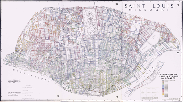
This site was created during the Spring and Summer of 2001, in an effort by the Metropolitan Research Design Center and Prof. Jacqueline Tatom, to create a publicly-accessible resource for researchers interested in the Wayman Maps. This site aims to make digital materials as easy to access as possible for researchers.
The following people contributed to this website:
- Professor Jacqueline Tatom is an Assistant Professor of Architecture at Washington University's School of Architecture. She is also Director of the Metropolitian Research and Design Center. Her research and writing has focused on developing the methodological tools to analyze and represent the urban form of contemporary cities, and to interpret the cultural context in which today's cities are made.
- Professor Peter Kastor is Assistant Director of the American Culture Studies Program in the School of Arts and Sciences at Washington University in St Louis. His research focuses on the Lewis and Clark expedition and American Expansion in the Early 19th-Century.
- Betha Witlow is Curator of the Visual Resources Collection in the Department of Art History and Archaeology in the School of Arts and Sciences.
- Eric Sandweiss is the Director of Research at the Missouri Historical Society.
- Joseph Sheehan is an undergraduate student at Washington University majoring in Engineering and Economics, with a minor in American Culture Studies.
About the MRDC:
The mission if the Metropolitan Research and Design Center is to advance understanding of the history and design of modern metropolitan areas, with particular attention to those of the Midwest and the Mississippi Valley. The MRDC seeks to provide information to practicing architects and designers, scholars in architectural design of the urban built environment and make it more responsive to locals needs, culture, climate, and geography .In particular, the Center intends to synthesize data, information, and research that relates socio-economic and technical processes that have shaped and are shaping the modern city to its specific physical forms.
Updates and Transition:
The Wayman Map information was transitioned from html to an Omeka exhibit in May 2016.
